Rural energy communities across North-West Europe want to cut carbon emissions and energy bills, but almost none of them know the energy performance of their own housing stock. A certified assessment — Ireland's BER, France's DPE, Germany's Energieausweis — requires a paid, in-person survey. For a community trying to profile hundreds of dwellings just to decide where to start, that cost and logistics gap is often the first wall they hit.
What we build
Within CIRCUS (Interreg North-West Europe), we developed a tool
that produces a first, reasonably accurate energy rating for a dwelling
from nothing more than its address, an Eircode in Ireland,
or a postal address anywhere across the CIRCUS partner countries.
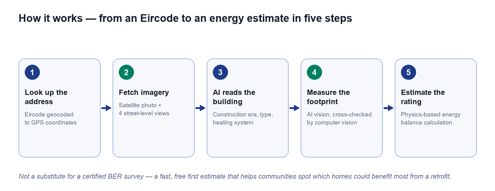
1. Geocode the address to GPS coordinates.
2. Fetch imagery: a satellite photo plus four street-level views of the building.
3. Read the building : a multimodal AI vision model cross-references all four views to judge construction era, building type, storeys, and heating system.
4. Measure the footprint : the same AI vision model estimates the building's dimensions from the satellite photo, cross-checked by a traditional computer-vision method for reliability.
5. Estimate the rating: a physics-based annual energy balance turns those measurements into an indicative energy rating and CO₂ estimate.
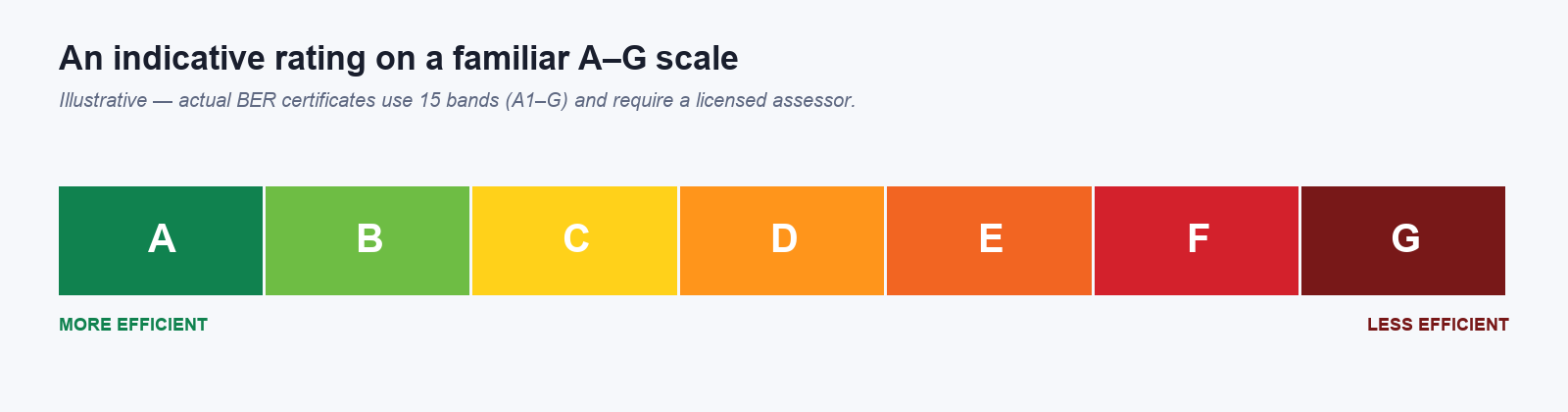 "An indicative rating on a familiar A–G scale."
The whole process takes under a minute and needs nothing
from the householder beyond their address.
This is deliberately not a replacement for a certified assessment: grants, regulatory compliance, and detailed retrofit specification still need a licensed surveyor. What it does give a community is something they currently have almost none of: a fast, free, first-pass picture of their entire housing stock, so they can:
- Prioritise engagement: start conversations with the households whose homes look most likely to benefit from retrofit, instead of surveying at random.
- Set a baseline: put a number on "how energy-inefficient is our area, roughly?" before committing budget to detailed audits.
- Engage residents: give a household a tangible, visual starting point ("your home is roughly a D") that makes an abstract decarbonisation target feel personal.
Because the tool already covers all eight CIRCUS partner countries, with country-specific climate data, electricity grid carbon intensity, and each country's own native rating scale (DPE, Energieausweis, EPC, Energielabel, GEAK…) alongside a common Irish-BER-style reference — the same approach demonstrated for rural Irish communities is directly transferable to any other CIRCUS partner region.
The methodology here , pairing free public satellite/street-level imagery with a multimodal AI model instead of manual measurement, is a low-cost pattern that could be adapted well beyond housing: any CIRCUS activity that currently depends on an expensive site visit just to get a rough baseline is a candidate for the same approach.